
Shelby Township ZIP Code Directory Coverage
Current official-government material places three practical delivery starting points around Shelby Township: 48315, 48316, and 48317. The Michigan ZIP boundary map is useful for broad orientation, but a result for one street must be verified through USPS. The rows below describe the documented Shelby-area examples rather than drawing a legal township line around every address. The last row is a warning about an older label, not an additional current Shelby assignment.
| ZIP | Areas covered | Post office | Notes |
|---|---|---|---|
| 48315 | Southern and eastern Shelby-area delivery shown on the official map. | Verify through USPS By Address. | An official 22 Mile Road example is in this delivery area; each street still needs confirmation. |
| 48316 | Central and northern Shelby-area delivery. | Verify through USPS By Address. | Township Hall uses this ZIP, but a mailing label does not by itself establish jurisdiction. |
| 48317 | Western and northwestern Shelby-area, often with Utica-associated postal language. | Verify through USPS By Address. | Utica Cemetery within the township uses this ZIP; postal identity can mislead a parcel search. |
| 48318 | Historical or legacy Shelby and Utica-area association. | Current street lookup required. | Do not call this a current Shelby ZIP without a current address result. |
The post office column is deliberately a verification route rather than a claimed station name. The research supports delivery zones and documented address examples, not a current machine-readable ZIP-to-township crosswalk.
USPS Lookup for Shelby Township ZIP Codes
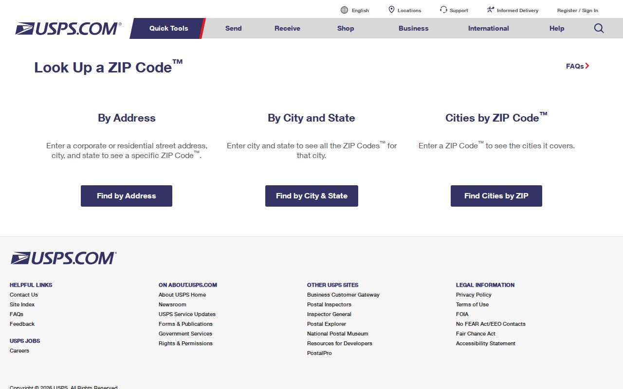
Use the official USPS ZIP Code Lookup before opening property records. Its By Address option requires Street Address, City, and State. Company, Apt/Suite/Other, and a current ZIP are optional. By City & State and Cities by ZIP are alternatives when a complete street line is not available. USPS can standardize a delivery line and return the postal city and ZIP or ZIP+4 where provided. It does not confirm that a particular person or company is at the address.
| USPS route or field | Entry requirement | Useful result or limit |
|---|---|---|
| By Address | Street Address, City, and State | Primary route for standardizing a specific delivery address. |
| Company | Optional | May clarify a business delivery but does not establish residential use. |
| Apt/Suite/Other | Optional | Keeps a unit-level delivery line distinct from a parcel. |
| Current ZIP | Optional | Can be supplied when checking a known address. |
| By City & State / Cities by ZIP | City and state, or ZIP | Alternatives for postal lookup, not proof of township jurisdiction. |
Open the official USPS ZIP Code Lookup form to standardize the delivery address first.
Save the returned street format, postal city, ZIP, ZIP+4 if shown, and search date. Those fields make it easier to compare a delivery result with the separate government parcel record.
Shelby Township ZIP Code and Parcel Matches
After USPS normalizes the address, search the Shelby Township BS&A portal for the property record. BS&A supports address, street-number range, name, parcel number, and building record number searches. It can return assessment, tax, sale, building, and special-assessment material. It is not documented as a ZIP-only resident search. A bare delivery code should therefore never be used as the sole input or as proof that an owner or taxpayer lives at the parcel.
Then check the address in the Macomb County GIS Parcel Explorer. GIS accepts a full or partial property address, community, or tax ID. The official guide says not to add a suffix such as RD, DR, AVE, BLVD, or CT when matching the property-address field. Its E911 All Known Address search can also use community and property name for apartment, condominium, or mobile-home address variants.
For ownership and legal land records, the Macomb County Register of Deeds is the controlling source. It answers who is listed on a recorded instrument and what legal description is attached, not which delivery ZIP a person uses.
Note: Record the USPS postal city separately from the GIS community and assessor result, because the three tools answer different questions.
Finding Residents Within a Shelby Township ZIP
A ZIP does not produce an official roster of people who live in a delivery area. The reliable task is narrower: standardize one address, verify whether its parcel is in Shelby Township, then examine the lawful record tied to that parcel or address. Once a ZIP has narrowed the place, the Shelby Township Street Directory has the fuller street-and-parcel workflow.
- Enter the complete street address in USPS By Address and retain the standardized line and postal result.
- Run that street line in BS&A, using a street-number range when the exact number does not match.
- Open the same address or parcel in Macomb GIS, confirm the community field, and preserve the tax ID or parcel identifier.
- Use the Register of Deeds only when the question concerns recorded ownership or legal description, not current occupancy.
- For an old street or rural route, compare the legal description with historical maps and plats before deciding two addresses are the same place.
The distinction protects both accuracy and privacy. A returned owner may be a trust, estate, or mailing contact, while an address point can be a unit, building, cemetery, business, or institutional site. Neither is a compiled resident list.
Utica in Shelby Township ZIP Results
Shelby Township is the Charter Township of Shelby in Macomb County, not a city. ZIP delivery geography does not follow municipal borders. A 48317 address can carry Utica-associated postal wording even while the local jurisdiction is Shelby Township. The reverse can happen elsewhere in the delivery area. Keep the USPS result and the government jurisdiction result together instead of replacing one with the other.
Postal versus government record. USPS answers how mail is delivered; BS&A and GIS identify the assessment record, parcel location, and local government context.
This mismatch is a local geography issue, not an error in either source. It matters when looking for a permit, tax, election, court, or township record because the postal city alone may send a researcher to the wrong office.
Shelby Township ZIP History and Maps
Modern delivery labels can be a poor match for older property research. Historic directories, plats, assessment rolls, and deeds may use a rural route, former township road name, or pre-standardized street number. The local bridge is the Shelby-area map material from 1904 and 1944, together with Macomb County plats from 1875, 1895, and 1916. Compare the legal description and map evidence before translating an old address into a current delivery line.
The Macomb County Heritage Alliance resource guide identifies these historical Shelby leads. No comprehensive official street-renumbering crosswalk was located. When a modern search fails, retain the raw historical address, test the street name without a suffix in GIS, and seek a library, archive, or Register of Deeds record rather than guessing a new number.
Shelby Township ZIP Terms Explained
Postal language becomes useful only when its scope is clear. The terms below separate a delivery refinement from a property or jurisdiction record.
- ZIP
- A Postal Service delivery area used to route mail. It is not a municipal boundary or a list of residents.
- ZIP+4
- An added delivery refinement that may identify a narrower delivery segment. It does not change the township boundary.
- PO Box
- A mailbox delivery address. It may be useful for correspondence but does not locate a residence or parcel.
- Carrier route
- A mail-delivery sequence or area used for routing. It is not a local-government district or ownership record.
Using a Shelby Township ZIP Carefully
A postal result should be treated as one field in a documented address trail. Write down the source date, returned city, delivery ZIP, ZIP+4 when provided, parcel, and the difference between a property, mailing, and E911 address. If the question is about a historic person or place, pair the current parcel with the dated directory, plat, or deed that supports the connection.
Make the note reproducible. Retain the original address as entered, the USPS-standardized line, the returned postal city, the assessor parcel, the GIS community field, and the date each source was checked. If a street number does not match, save the failed input as well as the number-range result. That record lets a later researcher test an old road name, unit address, or land description without silently replacing one source’s wording with another’s.
Dynamic records can change between visits. A subdivision may have an outside mailing contact, a property may be split or combined, and an address point may be corrected after the first search. Recheck the current USPS result before mailing a request, and preserve the legal description when comparing it with a historic plat or deed. A parcel number and a source date are stronger research anchors than a remembered postal label.
Do not infer a current resident from a ZIP, a property owner from a mailing line, or jurisdiction from a postal city. Access alternatives remain available when a portal does not answer the question: the Register of Deeds offers index, public-terminal, and request routes; library and archive holdings support historical research; and a properly described request under Michigan FOIA can seek existing public records from the relevant custodian. Michigan FOIA, MCL 15.231 et seq., calls for an adequately described written request, a response in five business days, and a possible ten-business-day extension. Ask for an existing map, parcel, or record series, not a newly created list of people.